
SHARE SLAM S20 3D LiDAR Scanner — Coming Soon
Short Description
COMING SOON TO LEADERS
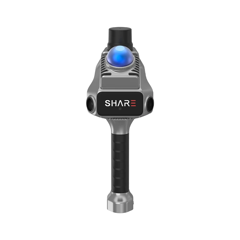
SHARE SLAM S20 handheld 3D LiDAR scanner for reality capture and building documentation. Device sales and our dedicated 3D scanning & surveying services are both coming soon.
Key Benefits
- ✓ Handheld capture for documenting buildings and project spaces.
- ✓ Colourised point clouds combine geometry with photographic context.
- ✓ Data supports CAD/BIM documentation and further modelling workflows.
- ✓ Coming Soon: S20 sales and a separate LEADERS 3D scanning service.
SHARE SLAM S20: a new dimension for LEADERS
Coming Soon — device sales and 3D scanning services. LEADERS FOR BUILDING EQUIPMENTS is introducing SHARE 3D (SHARE3DCAM) to its surveying range in Egypt, with the S20 handheld scanner at the centre of this upcoming offering.
The S20 combines laser and visual SLAM to capture spaces as 3D point clouds. Its two cameras add colour information, helping users interpret the captured scene when preparing drawings, reviewing existing conditions or planning further modelling work.
Where it fits
- Existing-building documentation and renovation planning.
- Site capture for architects, engineers and surveying teams.
- Point-cloud inputs for CAD/BIM workflows.
- Digital recording of spaces, structures and heritage environments.
From site capture to usable project data
Capture the site, process the scan, then review the point cloud against your project requirements. SHARE provides its Capture app and PointClouds Studio processing software. Final drawings, BIM models and other deliverables require the appropriate processing and modelling workflow; they are not automatically included with a scan.
Two upcoming options
Purchase the S20: device sales through LEADERS are coming soon. Contact us to discuss your intended application and upcoming supply details.
Use our scanning service: our dedicated 3D Scanning & Surveying Services division is also coming soon. Project scope, deliverables and launch arrangements will be confirmed separately.
Technical note: specifications below are published by the manufacturer. Range depends on target reflectivity. Accuracy and runtime depend on site conditions, capture method, positioning and processing. Equipment configuration, accessories and software licensing will be confirmed before launch.
Technical Specifications
Launch status, Coming Soon — device sales and services, Scanning system, LiDAR SLAM + visual SLAM, Point acquisition, 200,000 points/second, Measurement range, 0.1–40 m at 10% reflectivity; 0.1–70 m at 80% reflectivity, Relative accuracy*, Better than 1 cm (manufacturer specification), Absolute accuracy*, Better than 5 cm (manufacturer specification), Imaging, Two 1-inch cameras, 16 MP each, Shutter, Mechanical / electronic, RTK, Built-in as standard, Weight, 1,079 g, Dimensions, 110.5 × 140 × 313.3 mm, Battery runtime, Approximately 150 minutes per battery, Charging, USB Type-C, PD 30 W, Storage, 256 GB; expandable, Connectivity, Wi-Fi 6 (2.4/5 GHz), Type-C and TF card, Operating temperature, −20°C to +50°C
Specifications
Specifications
Specifications